
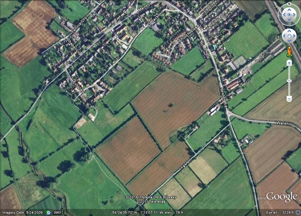
Walk 1 around 3-4 milesFollow footpath signed for Youlton at end of Main Street and cross the stile into field. Follow the well trodden path diagonally down the hill through opening into next field where you will see a wooden bridge across the stream (River Kyle). Cross this and continue to on the path as it follows the stream before turning left up a small (but steep) hill. Continue to follow the signposted path which follows the hedges around the fields. Eventually you will come to a point where you pass through some thick bushes and you will find a gate. Pass through this and immediately go left and over another small bridge. Follow the path until you access a large field with a long hedge on your left. Follow this until the end where you will pass through several stiles to enter Youlton. Turn right once you reach the tarmac and then follow road home to Tollerton. You can follow the road all the way back to Tollerton but you will come across an alternative final path into the village shown in this picture. |
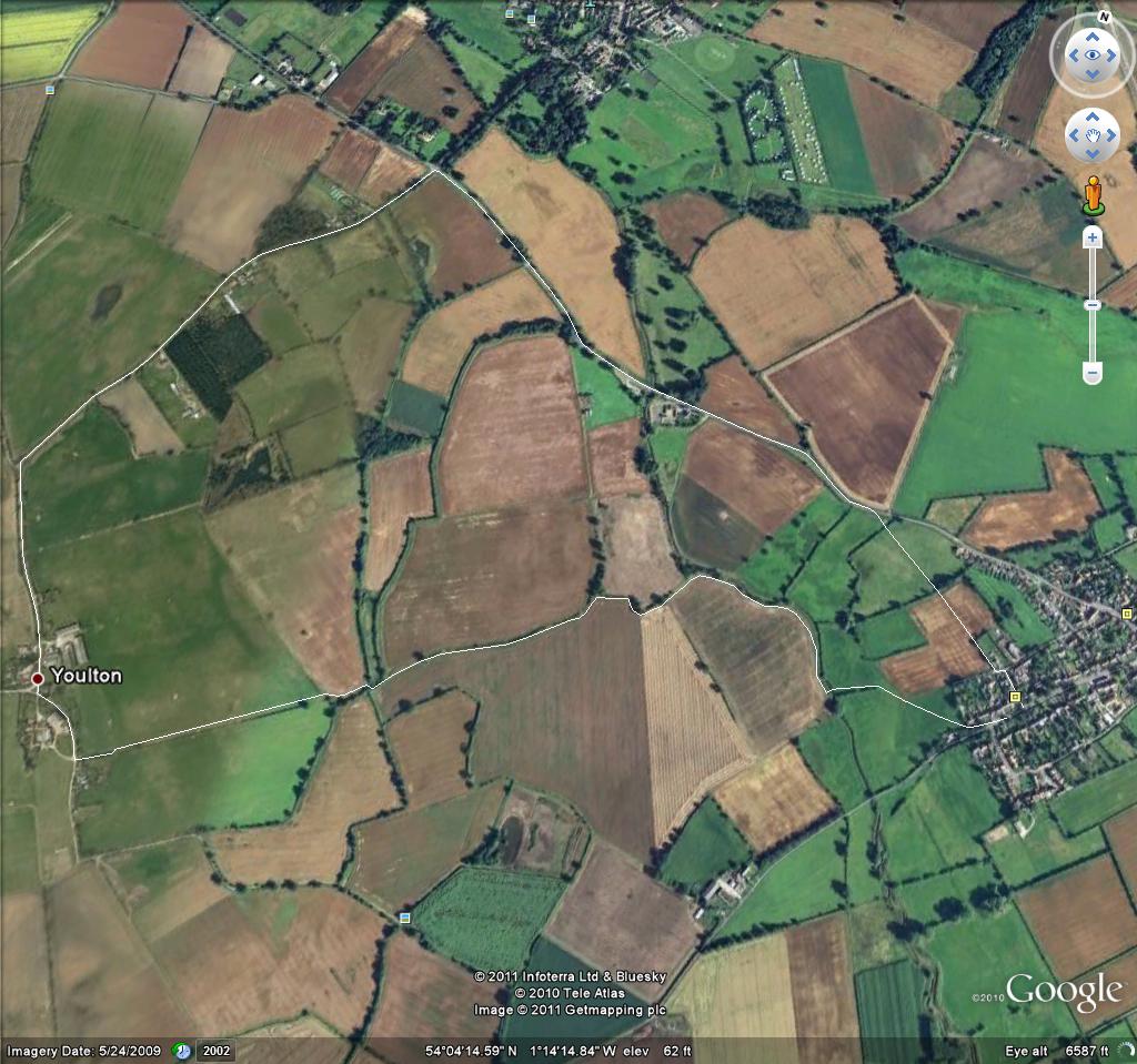 |
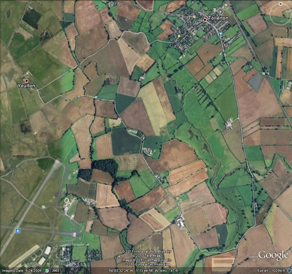
Walk 2 around 5-6 milesThis uses the same route to Yourlton as walk1. Follow footpath signed for Youlton at end of Main Street and cross the stile into field. Follow the well trodden path diagonally down the hill through opening into next field where you will see a wooden bridge across the stream (River Kyle). Cross this and continue to on the path as it follows the stream before turning left up a small (but steep) hill. Continue to follow the signposted path which follows the hedges around the fields. Eventually you will come to a point where you pass through some thick bushes and you will find a gate. Pass through this and immediately go left and over another small bridge. Follow the path until you access a large field with a long hedge on your left. Follow this until the end where you will pass through several stiles to enter Youlton. At Youlton when you reach the tarmac turn left and follow the path (Hag Lane) which is part of National Cycle route 65. Follow the track and eventually you will join a tarmac road - Linton Woods Lane. You now follow this for around 1.5 miles - during which you pass Lodge Farm Kennels and a series of other farms and converted barns. Continue until you reach a sharp right hand bend with a large farm (Linton Woods Farm) on your left hand side. At the last of the farm buildings you will find a signed path through a hedge and small woody area that leads you once more into the open countryside. Follow this marked path around the edge of the farm and then down a path with trees that leads you to another bridge over the River Kyle. Once over the bridge turn left and aim through the fileds to join the Tollerton - Newton-on-Ouse Road. Sadly the rest of the route is on this road. |
 |
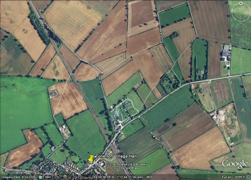
Walk 3 around 2 milesThis is called the Railway Walk as to complete it you need to cross the East Coast Mainline! The route starts from Back Lane from which you turn right onto the farm track called Moorlands Lane. Follow this down round a left hand bend and past some farm building on your right. Once past these the track opens up with a field to your right and the Water Treatment Works a small distance in front of you. Follow the sign that directs diagonally across this field on your right (the track is usually very visible from use). Follow this route over the field and you will see a gap between trees that you can pass through into the next field. The stile onto the Railway is easily seen from here. There are 4 tracks and a set of red/green lights for each track - the first set of 2 tracks are for trains going north (so will be coming from your right) and the next 2 are for south bound trains. Always look carefully before crossing but if any of the lights are green then be particularly careful as the mainline trains are very fast on this stretch of track.** Having crossed into the next field walk straight ahead with ditch on your right for the short distance to Sidings Lane. Turn right down the lane and follow it until you come to sharp right and then left bend. You can follow this lane back to tollerton as a shorter version of this route but the path suggested turns 90 degrees left at the first right turn. Cross the field in a straight line heading for the hedge at the far side as you get closer to the hedge you will see that the path passes to the right of it and then enters the field immediately behind the hedge - follow the right edge of this field so you pass down the left of the hedge when you get to it. This will take you onto Intake Lane where you need to turn left. Follow the lane passing 2 fields on your right until you reach an entrance into the third field at its right hand edge - it has a hedge running down its full length on the right. Follow the hedge down to the end of the field. At the next field it is simplest to just turn right and follow the ditch down the right side of the field. As you reach the end of the field you will see a wooden bridge across the ditch. Cross this then you need to cross the field almost at the same angle as the first section of hedge on your left. Crossing this will take you once again to Intake Lane. You should see a sign for the right of way but basically go straight across the lane entering the next field and follow the left edge of this. This will take you past the back of Poppy Crofy and the Allotments. At the end of the allotments travel across the field to the stile (you should see the gap in the hedge). At the next field follow the trampled path across into the Caravan Park. Here you need to continue bearing slightly to the left until you reach the trees on the left side of the park. Follow these until you reach a little bridge that takes you across the ditch and onto Skes Lane - turn right and head back into Tollerton. **Please note - you cross the line at your own risk but the crossing is a designated right of way. |
 |
Walk 4 just over 1 mile
|
 |
Tollerton menu
Aldwark Area menu
Tholthorpe
Local Information
General advice

Click above for advice on reporting suspicious email